Lab 3 [GIS5050L]: GIS & Cartography
Built using ArcGIS Pro 2.0
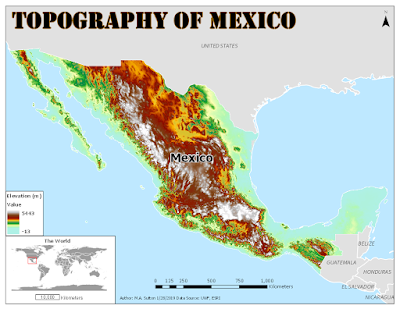
This map shows the topology of Mexico (measured in meters) with an inset map demonstrating the placement of this country in the world setting. The color ramp selected for the elevation data was based on one of the standard ramps used for elevation inside ArcGIS. The map can be improved by selecting a lighter color blue for the background ocean information so the elevation information near the coastline is more prominent.


Comments
Post a Comment